There are numerous satellites orbiting the Earth, performing various tasks, and their results are an important resource for scientific research and smart decision-making in different spheres, including agriculture. Satellite monitoring makes it possible to effectively manage land, monitor the condition of crops, and identify potential threats. Satellite imagery shows up-to-date information that can help farmers solve problems in time and assess the condition of their crops.
This technology is already widely used across world countries. Satellite imagery helps to detect unused areas of land, to make an accurate map of lands, and to plan agricultural activities more efficiently. Groundwater and mineral springs can be detected from orbit; the transfer of pollutants from the ground into waterways and topsoil erosion can be monitored. Satellites can be used to monitor important factors such as weather, temperature, rainfall patterns, water stress with the help of NDWI index, crop development, and more.
Smart Water Management
Modern agriculture often uses water inefficiently to irrigate crops. Today, more than half of all irrigation water is wasted due to runoff, wind, and evaporation. Instead of being retained in the root zone, water bypasses the plant root system and seeps into groundwater, dissolving and flushing out nutrients (nitrogen fertilizers). Precision irrigation technologies make it possible to use as much water as the plant needs.
Click here – The Most Prominent Benefits Of Virtual Therapy
Proper Water Management Helps:
- Reduce water loss
- Overcome the topographic constraints of fields
- Create optimal conditions for plant growth
Modern precision irrigation technologies, both for outdoor and greenhouse crops, rely on information from moisture sensors, weather monitoring systems, and measurement of crop water content based on vegetation indices like NDWI.
This index helps growers manage irrigation effectively based on crop need for water, which is especially critical in areas where this resource is as valuable as gold.
The NDWI formula looks like this: NDWI = (Green – NIR)/(Green + NIR)
Green wavelengths “represent” the reflectance of the water surface, while near-infrared — the reflectance of terrestrial vegetation and soil features. This enables detection of moisture content in plants, therefore leading to data-based irrigation.
Soil And Crop Condition Monitoring
To get the most out of the crops, farmers need to provide them with everything they need. This is only possible with a comprehensive approach. First you need to do an agrochemical analysis of the soil, finding out how much nitrogen, phosphorus and other substances are already there. Then, based on the needs of the crop to be planted and the soil composition data obtained, you can figure out how many substances to apply to the soil.
For this, spectral analysis of satellite imagery can be used. Such analysis implies the use of different indices, including NDVI, Normalized Difference Water Index, and many others to get the full picture of the field, its productivity, the state of each particular zone, etc. Monitoring of all those conditions remotely helps reduce time on field inspection, save resources and money thanks to precision, and obtain higher yields in a sustainable way. More so, this data can be used to forecast yields in advance.
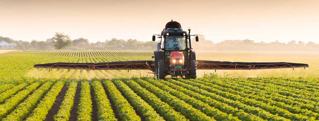
Automated Machinery
Satellites have also gifted humanity with GPS technology, In agriculture, modern GPS-navigation has many advantages: it helps to reduce fuel costs, shows the efficiency of the equipment used, determines the amount of machinery involved, in what direction this vehicle is moving and at what speed, as well as monitors how accurately the employees perform their duties. Without special devices, it’s hard for a person to achieve maximum accuracy in carrying out agricultural operations. By installing a GPS-navigator to the agricultural machinery, a person will fully automate the work, because the navigator will fully control the operation of a vehicle. Of course, one navigator in the tractor is not enough, and a human resource for its control is still needed to fully manage all the necessary processes. It should be noted that in agriculture, in addition to GPS, there are two types of navigation-assist devices: parallel driving systems and autopilots.
Click here – How Can a Lawyer Help Me After a Car Accident?